
Basic Trail Information
Dates: 4/2 – 4/4
Miles: 17.9 mi (5.2 miles of day hike)
Trailhead: Prisoner’s Harbor
Location: Santa Cruz Island, Channel Islands National Park
Trail Type: Point to Point
Elevation Gain: 2,600 ft (600 ft on Day 1 & 2,000 ft on Day 2)
Permit: Campsite reservation required
Highlights: Coastal scenery, rare wildlife, meadows, wildflowers, bird watching

Getting There
The only way to get to Santa Cruz Island at Channel Islands National Park is by boat. The only company to operate to and from the island is Island Packers (https://islandpackers.com).

We booked a boat reservation through Island Packers with the drop-off spot as Prisoner’s Harbor SCI and pick-up spot to be Scorpion Cove SCI. In 2021, the cost for each one-way was $42.00, or $84.00 roundtrip.
Island Packers operates from several harbors, but our trip departed from Ventura. We parked in one of the long term parking lots, “Whale or Turtle Lot,” and were provided with a parking permit once we checked-in.
Day 1: Prisoner’s Harbor to Del Norte Backcountry Campground
Total Mileage: 3.5 miles
Our boat ride with Island Packers was scheduled for 9 AM. They departed exactly on time after loading everyone’s gear and it took about 1 hour and 45 minutes to get to Prisoner’s Harbor.
As someone who gets seasick easily, the boat ride was pleasant and not choppy; however, I’ve read online reports of very choppy rides so I was prepared with dramamine in case I got seasick.

After docking, we started our trek to Del Norte Backcountry Campground.
The trek was moderately strenuous, given that we had to carry all of our water for the first couple of days. We brought all of our water with us (3 liters per person) because there is no water at Prisoners Harbor or at Del Norte Backcountry Campground.

The initial section of the trail was a gravel road called Navy Road that ascended for about 1.5 miles before following a rugged trail. Most of the 600 foot elevation gain was in the first 1.5 miles. Some areas were quite steep and the trail had little to no shade, so we took a couple water breaks to hydrate and catch our breath. This section is also used by vehicles and a car drove past us while we were hiking on the trail.
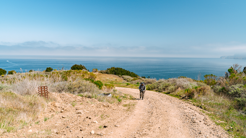
Once we hit the rugged trail, we continued for another 1.8 miles where the trail winded up and down the hills. The terrain was distinguished mostly by low lying sage scrub plants. We hit a junction and walked a short distance until we arrived at our primitive campground.


Del Norte Backcountry Campground was nestled in a shaded oak grove with panoramic views overlooking the coastline. There were a total of 4 campsites; our campsite was site #1. Our campsite had an animal-proof container to prevent animals from getting to our food and a wooden picnic table. A short walk away was a pit-style toilet. There was no trash can, so we packed out all of which we packed in.


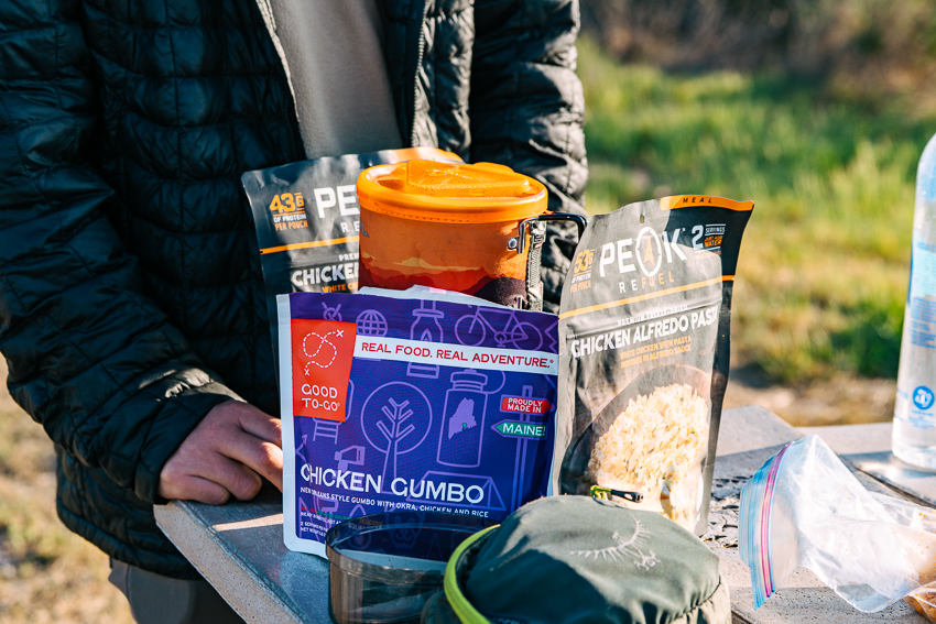
For dinner, we enjoyed Good To-Go’s chicken gumbo and Peak Refuel’s chicken alfredo pasta. We admired the sunset, enjoyed the solitude, and headed to bed early.

Important Note: Please do not bury your trash. I noticed some trash buried and dug up by animals at our campsite. I reported it to NPS after our trip and they had someone hike in to remove the trash. Please be respectful to our public lands.
Day 2: Del Norte Backcountry Campground to Scorpion Canyon Campground
Total Mileage: 9.2 miles

Our morning started off with breakfast and watching an Island scrub-jay, a vibrant blue endemic bird restricted to the island of Santa Cruz, drinking water from morning dew on our picnic table. Morning bird songs filled the air as we packed up our tent and headed out to start our day.
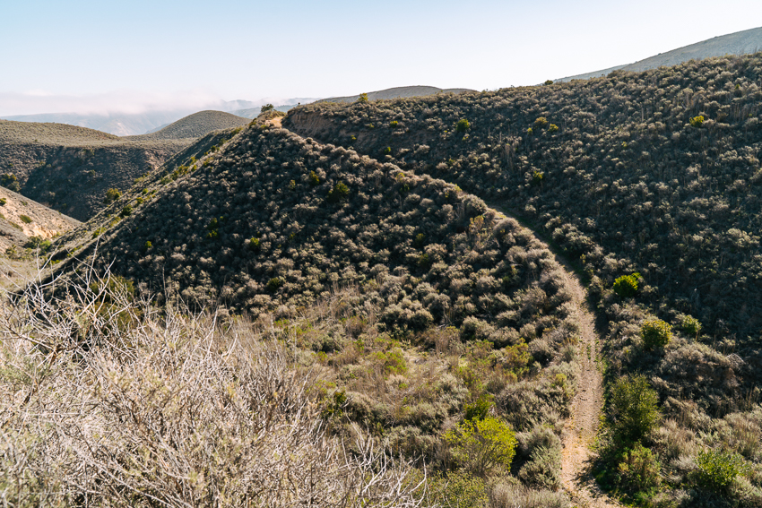
The 9.2 mile journey wove through rolling hills and along ridgelines with steep exposed slopes.

The descent on the far end of the mountain down the high point had a lot of loose rocks, so we were extra careful since we were carrying heavy packs. Along the ridge, we had incredible coastline views of Santa Cruz Island.

Since it was Spring, wildflowers were in bloom in large patches.


The vegetation varied from coastal sage scrub brushes, grass patches, to rocky terrain. Some sections of the trail were overgrown with vegetation, so we regularly checked our pants for ticks since they are present on this island.


With a near empty trail, it was a quiet and pleasant hike.


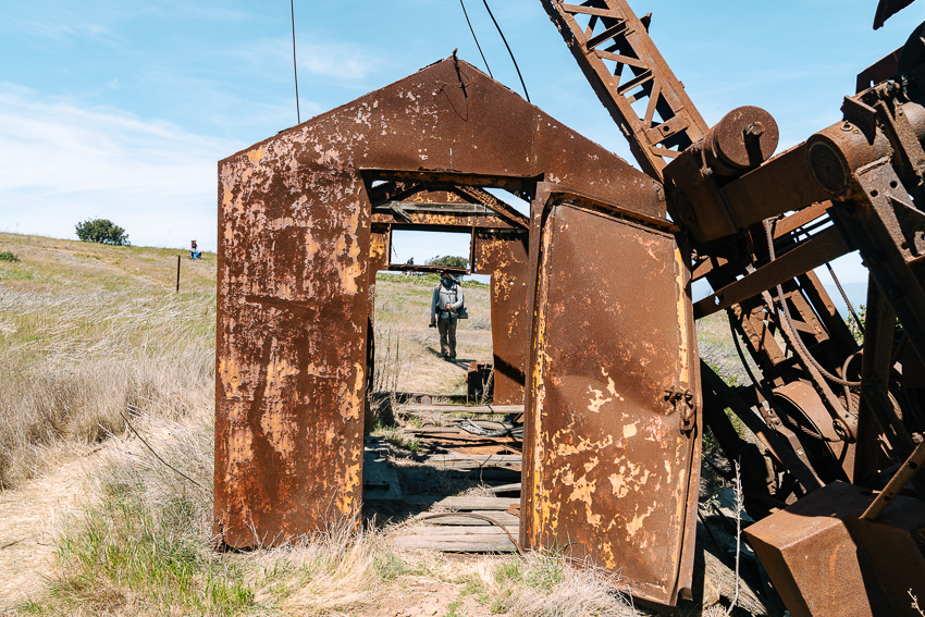
About 7.5 miles into the hike, we came across an abandoned oil well on the right side of the trail. We stopped to take a snack break, explored the rusted oil well, and then continued on our way. We immediately approached a trail junction where the Montanon Ridge Trail turned into Scorpion Loop Trail.

After a short descent down to Scorpion Canyon Campground, we finally arrived at our campsite #23. We met up with our friends who boated in on the same day and explored the campground together.

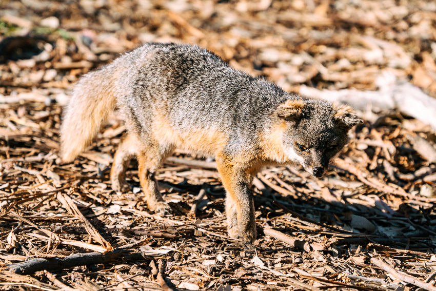
The rare island fox, that only lives on the Channel Islands, were playing in the tall grass, walking through campsites, and snoozing around in the open. They were cute and playful, and definitely not afraid of the campers nearby.

Day 3: Scorpion Anchorage to Home
Total Mileage: 5.2 miles (day hike)

The morning after, our friends, Linard and I went on a short hike to Potato Harbor Vista Point, a 5.2 mile trail with 600 ft elevation gain.
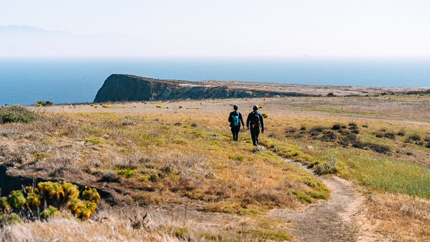
The trail skirted along the cliff through yellow wildflower-dotted grassy plains before reaching a view of a harbor.


You could also see Anacapa Island in the distance, the closest Channel Island to the mainland.

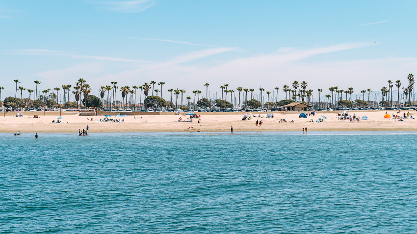
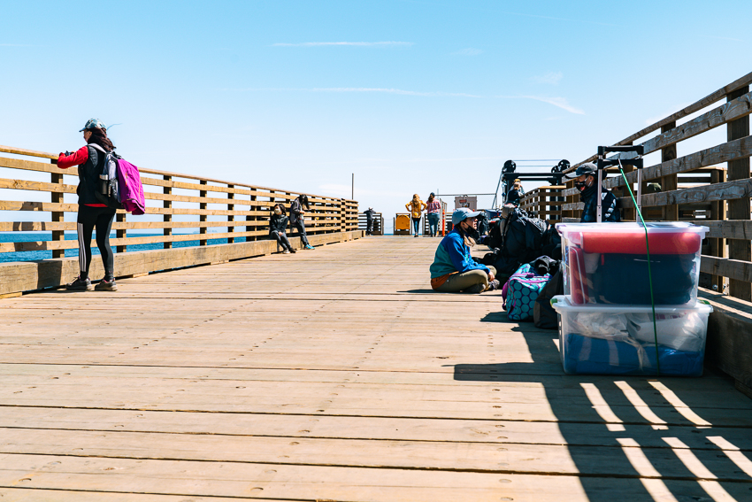
We leisurely hiked back to make it in time for our boat ride back to Ventura from Scorpion Anchorage at 12 PM.

On the boat ride back, the captain stopped the engine briefly after spotting humpback whales. It was our first time witnessing whales in their natural habitat. We also spotted dolphins and plenty of pelicans, seagulls, and other birds.


Important Notes
Water: In addition to Prisoner’s Harbor, there is no water at Del Norte campsite, so be prepared to carry your water in. There is water available, however, it is at Scorpion Canyon Campground. We carried 3 liters of water per person; though, we only used half of that.
Ticks: Ticks are present on the island and can carry diseases so make sure to regularly check your body if you walk through vegetation. The vegetation was overgrown in certain sections of the trail and we both checked very regularly – luckily, no ticks for us!
Poison Oak: Similar to the mainland, watch out for poison oak! They are commonly on slopes and in shaded canyon areas.
Primitive Island: The island is remote and largely labeled primitive due to the absence of infrastructure. Keep in mind that there are no supplies on the island and emergency services are limited.


